- galibier
- izoard
- telegraphe
- six
- days
- through
- the
- high
- alps
- bike
- cycling
- french
- surly
- long
- haul
- trucker
- weighed
- kilograms
- Adventure category: cycling.
- Location: French Alps.
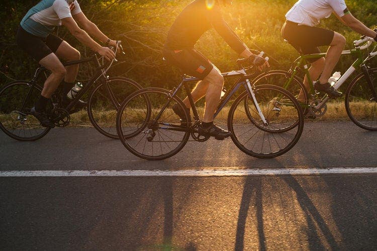
- The Surly Long Haul Trucker weighed 23 kilograms loaded. I know because I weighed it in the car park in Saint-Jean-de-Maurienne on a borrowed luggage scale and then stood there doing math that I didn't like. My own body weight plus the bike plus the bags equalled something that felt, pushing up the first ramp of Col du Telegraphe at 7 a.m. on a Tuesday in August, like a serious personal failing.
- This is the honest beginning of the six-day alpine route that connects Saint-Jean-de-Maurienne to Briançon via the three great passes of the Route des Grandes Alpes. Nobody tells you about day one. Everyone talks about Galibier.
- Col du Telegraphe sits at 1,566 metres — modest by Alpine standards, significant when you're carrying four Ortlieb panniers and a bivouac setup. The climb is 11.8 km at an average 7.1% gradient. In the Tour de France, riders do it before Galibier without stopping, as a warmup. With luggage, it takes the better part of three hours and requires a recalibration of what "difficulty" means.
- Valloire, in the valley between Telegraphe and Galibier, has a café that opens at 8 a.m. I arrived at 10:30. The patron looked at the bike, looked at the panniers, looked at me, and brought out a plate of bread and butter without being asked. That café stop, which lasted forty minutes, is one of my clearest memories of the entire trip.
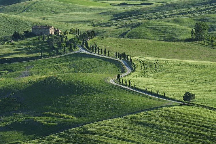
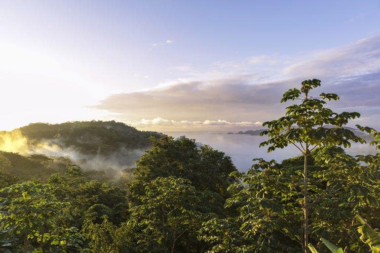
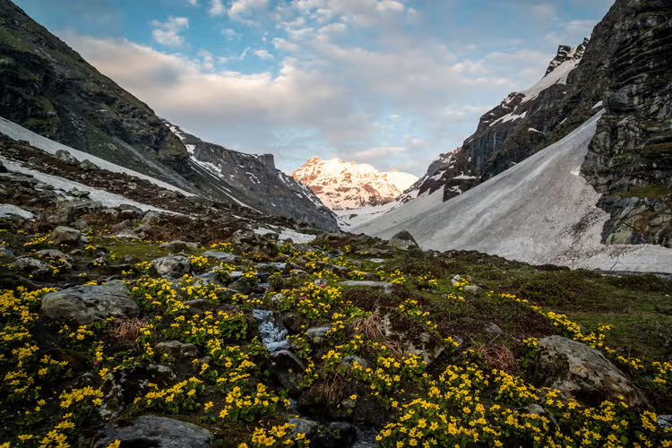
- Between Galibier and Izoard, the route descends through places like this. The legs don't feel it yet. They will.
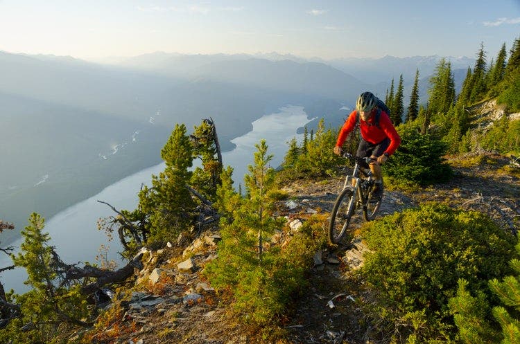
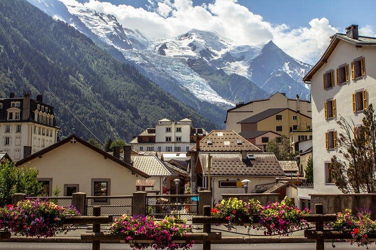
- Col du Galibier at 2,642 metres is not the highest pass on this route but it is the most famous, and the fame is earned. The final four kilometres above the Lautaret junction are on exposed terrain above the treeline, switchbacking up a stone face with nothing to stop the wind and nothing to stop you looking back down the valley and feeling small in a way that feels good rather than frightening.
- There is a café at the summit. It serves hot chocolate that costs an unreasonable amount and tastes better than any hot chocolate I have ever had anywhere. I sat outside in a fleece and base layer — it was 7°C at the top even in August — and watched other cyclists arrive at the summit. Everyone, without exception, did the same thing: stopped, looked around, and went very quiet for a minute.
- lofoten
- islands
- arctic
- surfing
- the
- top
- world
- water
- geirangerfjord
- norway
- most
- surfers
- when
- you
- describe
- where
- heading
- picture
- Adventure category: water.
- Location: Geirangerfjord, Norway.
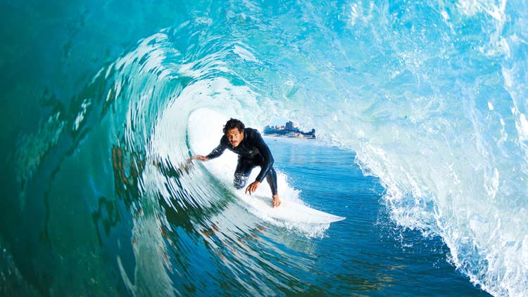
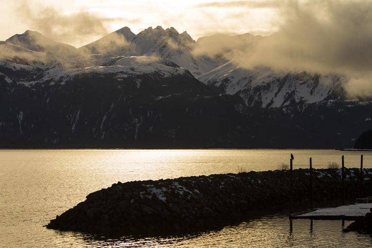
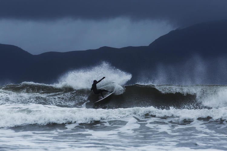
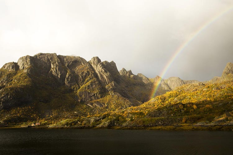
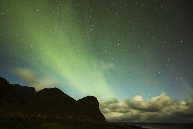
- Most surfers, when you describe where you're heading, picture something warm: Indo barrels, a reef in the Canaries, maybe Morocco on a budget. When you say "Norway, above the Arctic Circle, in November," they look at you the way people look at a car that has just driven slowly into a lake. And yet the Lofoten Islands have produced some of the most photogenic, most consistently hollow surf in the North Atlantic — and for years, a small community of Norwegian surfers have had it almost entirely to themselves.
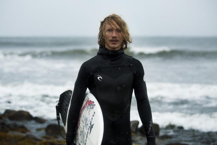
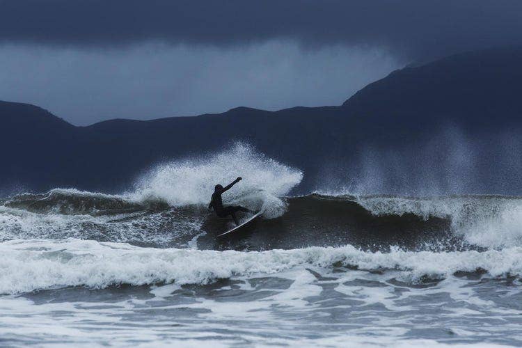
- What drew me north was a photograph taken at Unstad beach — a perfectly A-framed left-hander breaking in front of a sheer mountain wall, the surfer tiny against the granite, snow dusting the summits above the whitewash. The image has done more for Arctic surfing tourism than any article ever written. It is entirely honest: the waves look exactly like that, the mountains are exactly that close, and the cold is exactly as implied by the grey-green water in the frame. You should go knowing all three of those things are real.
- Lofoten's surf is driven by North Atlantic low-pressure systems tracking northeast across open ocean. The fetch is enormous — thousands of kilometres of open water between Iceland, the Faroe Islands, and the Norwegian coast — which means when a swell arrives, it arrives organised. Clean lines, consistent period, predictable direction. The archipelago's west-facing coastline catches the dominant swell window directly, and the offshore topography funnels and focuses energy into the bays between the headlands.
- The flagship break is Unstad, in the Vestvågøy municipality: a sheltered bay flanked by the kind of mountains that make every other surf spot feel geographically modest. The break works on both sides of the bay, offering a right and a left depending on swell angle. At head-high to overhead, both are exceptional — fast, clean, with enough wall to work and enough power to require commitment. At double overhead and above, the left in particular becomes serious: it throws harder and closes out in sections if you misread the peak. Local knowledge about where to sit in the lineup is not optional at that size.
- Beyond Unstad, the Lofoten coast offers a dozen lesser-known breaks spread across the outer islands. Eggum, twenty minutes north of Unstad, produces a long, workable right-hander over a mixed sand-and-reef bottom that handles bigger swells better than Unstad and attracts a fraction of the crowds. Flakstad, further south toward Moskenesøya, has two breaks within a few kilometres of each other that produce quality surf on a more northerly swell direction when the main window is too direct for Unstad to handle cleanly. The islands reward exploration and punish laziness about checking conditions before driving.
- "The ocean here doesn't care that you drove fourteen hours to get here. It has its own schedule, and patience is the only strategy that works."
- Season matters enormously. The prime window for Arctic surf tourism falls between September and March, when the North Atlantic storm track is most active and swell frequency is highest. October and November offer the best balance: surf is consistent, daylight is reduced but not yet at its December minimum, and the water temperature — while cold enough to demand serious neoprene — has not yet dropped to its February low of around 4°C. Spring sessions from February to April are possible but demand the most from your rubber and your cold tolerance. Summer is largely flat, with the compensation of the midnight sun and warmer water — but if you're coming for waves, summer is not your season.

- hours
- the
- sonoran
- field
- guide
- desert
- survival
- death
- valley
- usa
- not
- featureless
- wasteland
- that
- first
- thing
- unlearn
- one
- Adventure category: desert.
- Location: Death Valley, USA.
- The Sonoran is not a featureless wasteland. That's the first thing to unlearn. It is one of the most biodiverse deserts on earth — over 2,000 plant species, 550 vertebrate species, and more than 100 species of reptile. What it lacks is forgiveness. The same conditions that produce extraordinary diversity also produce extraordinary danger for anyone who arrives unprepared or underprepared. This guide is about the latter.
- The number is 4 litres per person per day in summer heat. Not 2 litres. Not "more than usual." Four litres, minimum, and that assumes you are not doing strenuous activity in peak afternoon heat. If you are hiking in July, in direct sun, between 10 a.m. and 4 p.m., you can lose a litre of water per hour through sweat. Your body will not register thirst until you are already mildly dehydrated. Drink before you feel the need.
- Natural water sources in the Sonoran are scarce, seasonal, and often contaminated with animal waste. Tinajas — natural rock basins that collect rainwater — exist but cannot be relied upon. Carry all the water you need for your planned distance plus a 25% emergency reserve. A 3L hydration bladder plus a 1L hard-sided bottle gives you redundancy if one system fails.
- Electrolytes matter as much as water volume. Hyponatremia — low sodium from drinking too much plain water without replacing electrolytes — is a real risk on long desert days. Carry electrolyte tabs or powder and use them whenever you're drinking heavily.
- Dawn start. Every experienced desert hiker says this and most beginners ignore it until they've made the mistake once. In summer, temperatures in the Sonoran reach 40°C or above by 10 a.m. If you start hiking at 6 a.m., you can cover 10–15 km in comfortable temperatures before the heat becomes a management problem. If you start at 9 a.m., you will be in danger before you've gone anywhere.
- The midday rest protocol — finding shade and stopping between roughly 10 a.m. and 3 p.m. — is not laziness. It is how desert-adapted cultures have survived in these environments for thousands of years. A sun hoody with UPF 50+ coverage is more effective than sunscreen alone, covers more surface area, and doesn't wash off in sweat. A wide-brim hat is not optional — your neck and ears are high-risk burn areas that most people neglect.
- The Sonoran is not actually featureless, but it can feel that way when you're in it and disoriented. The saguaro-studded flats in particular have a rhythm that can trick you into thinking you've passed a landmark when you haven't. Carry a map and compass in addition to your phone or GPS — batteries and signals fail. Learn to take a bearing before you need to.
- the
- camera
- your
- back
- practical
- and
- philosophical
- guide
- photography
- dolomites
- italy
- day
- nearly
- left
- behind
- was
- col
- galibier
- Adventure category: photography.
- Location: Dolomites, Italy.
- The day I nearly left the camera behind was on the Col du Galibier, day two of the alpine cycling route. It was 6 a.m. and the panniers weighed 23 kilograms and I was standing in a car park deciding what to take. The camera bag — Sony body, two lenses, two batteries, four memory cards — weighed 1.4 kilograms. Not much, in isolation. But at that point in the morning, looking up at the switchbacks ahead, every gram was a decision.
- I took it. I have never once, at the end of a trip, regretted bringing the camera. I have, on several occasions, regretted not being sufficiently present while I was using it. Those are different problems with different solutions, and conflating them is the source of most of the "leave the camera home" arguments you'll read from people who are tired of being asked to photograph things at inconvenient moments.
- The system I've settled on after six years of iteration: a Sony A7C II with the 20mm f/1.8 G as the primary lens, and the 85mm f/1.8 when I know I'll be shooting people or wildlife at a distance. That's it. No zoom, which is the controversial part of this setup.
- The argument for a versatile zoom (24-105mm, say) is range and flexibility. You can shoot landscapes and compress the middle-distance and get medium telephoto all from one lens. The argument against, in a mountain context, is that a good zoom weighs between 700g and 1kg and a prime — a sharp, fast one — weighs 200–400g. Over six days, that matters. More importantly: shooting with a fixed focal length is a discipline. You have to move to compose. You have to commit to a perspective. You can't zoom your way out of a bad position.
- The Peak Design clip system attaches to a pack strap and keeps the camera body accessible without having to open a bag. This matters because the shots that disappear in the time it takes to unpack a camera are exactly the shots you came for: the condor banking overhead, the light catching a snowfield for thirty seconds before the cloud moves back in.
- I learned about light patience from a landscape photographer I met in the Lofoten Islands who was waiting at a specific rocky point for the third consecutive evening. The light he wanted — a particular combination of cloud diffusion and low angle sun that would illuminate a sea stack differently from how it normally appeared — had not materialized on the first two evenings. He was back for a third attempt. He had no guarantee. He waited with a thermos and a patience I found almost incomprehensible, having a deadline and somewhere to paddle the next morning.
- He got his shot on the third evening. I know because I was nearby, and the light that came was unlike anything I had seen from the water during the previous week. It lasted eleven minutes.
- circuit
- days
- 115
- one
- life
- changing
- walk
- trekking
- torres
- del
- paine
- chile
- planned
- this
- trip
- for
- eleven
- months
- Adventure category: trekking.
- Location: Torres del Paine, Chile.
- We planned this trip for eleven months. We packed our bags the week before departure, repacked them the day before, and still got things wrong. The W Circuit through Torres del Paine National Park is one of the most famous multi-day treks in the world, and the reputation is deserved — but the version in the glossy travel supplements is missing about forty percent of the story. This is the rest of it.
- The bus from Puerto Natales takes roughly three hours to reach the park boundary. On a clear day you can see the towers from the road, three granite spires that seem to belong to a different planet. We arrived to drizzle and low cloud, which the ranger at the gate found amusing. "November," she said. "Perfect timing." She did not mean it sarcastically, which was somehow worse.
- We started from Laguna Amarga and walked west toward Campamento Torres. The trail is well-marked. Too well-marked. The sheer volume of trekkers on the first two sections caught us off guard — the W Circuit draws close to eighty thousand visitors a year, and you feel it on the main arteries. This is not wilderness solitude. It is something else: a shared experience of difficult terrain and unreliable weather and spectacular landscape, conducted with strangers from thirty-two countries.
- Day two was the mirador climb. Four hours up to see the towers at sunrise, if the cloud lifts. We left camp at 4:30 a.m. The cloud did not fully lift. What we saw was the towers appearing and disappearing through moving mist, which — honestly — was better than the postcard version.
- Patagonian wind is not weather. It is a physical condition of the place. On day three, crossing the exposed ridge section above Valle del Francés, the gusts hit around 80 km/h by our estimation — though "estimation" is generous since neither of us has ever stood in 80 km/h wind before and it seemed faster. Morgan's trekking pole went sideways. We leaned into it and kept moving, one step at a time, not because it was dramatic but because stopping was not an option and turning back would have added six kilometers.
- "By day four we had stopped asking when it would stop raining. The question had become whether we still cared."
- The French Valley itself is one of the most extraordinary places either of us has ever stood. Glaciers calving off the north face of the massif, ice chunks detonating into the lake below. The sound arrives two seconds after the visual. You watch it happen and then the sound finds you, and it registers somewhere below language.

- pavones
- and
- playa
- negra
- finding
- your
- feet
- costa
- rica
- breaks
- water
- nosara
- has
- been
- the
- surf
- map
- for
- Adventure category: water.
- Location: Nosara, Costa Rica.
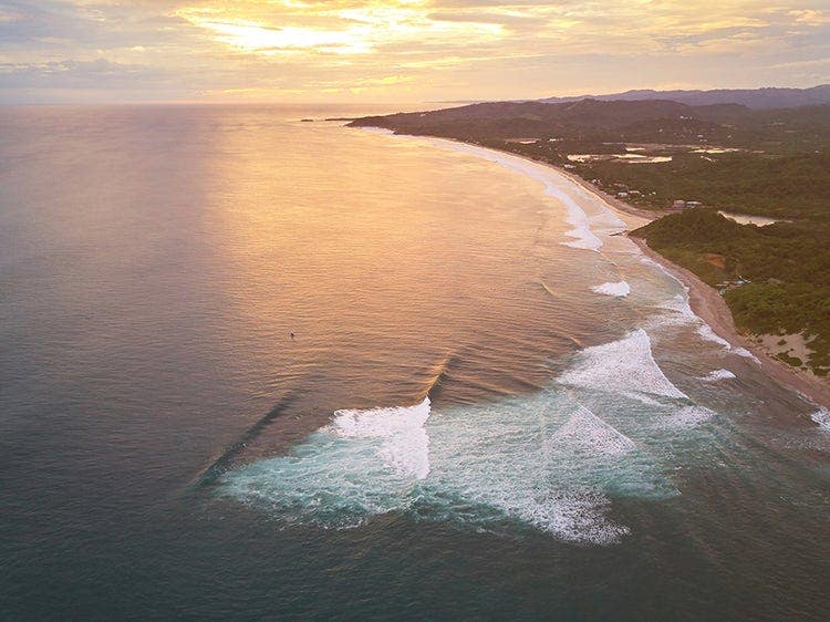
- Costa Rica has been on the surf map for forty years and the waves haven't changed, which is the whole point. What has changed is who's standing in them. On any given morning at Playa Negra you'll find retired pro surfers living in the hills, twenty-year-old Instagram instructors with inflatable boards, and local kids who've been surfing since before they could read. All of them have valid claims to the water. Navigating that requires understanding more than just how to paddle.
- Costa Rica's Pacific coast has two distinct seasons and the breaks behave differently in each. The dry season (December to April) brings consistent NW swells to the northern Nicoya Peninsula — Playa Negra near Puerto Viejo de Talamanca on the Caribbean side, and Tamarindo and Santa Teresa further north on the Pacific. The green season (May to November) flips the swell direction, and the south-facing breaks like Pavones come alive.
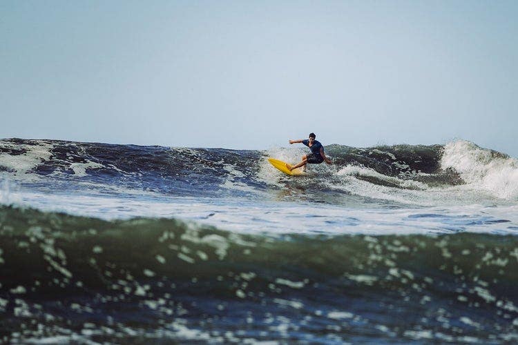
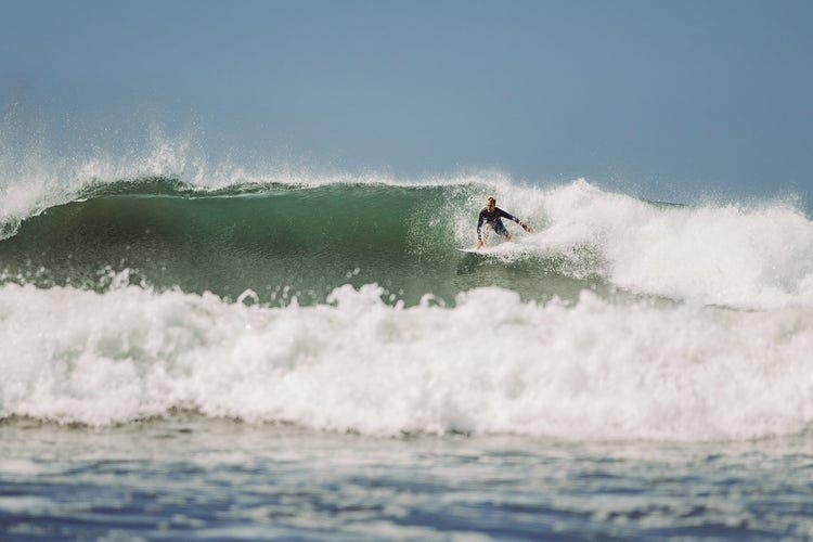
- Pavones, near the Panamanian border, is one of the longest left-hand point breaks in the world. On a good day it runs for over 700 metres. On a bad day — too much swell, too much current, too many people who've seen the same YouTube videos — it is not a beginner wave. Neither is Playa Negra on its overhead days. The mistake tourists make is confusing "warm water" with "easy water." The reef doesn't care about your Instagram grid.
- Before you paddle out anywhere, spend twenty minutes watching. Not photographing. Watching. Look for:
- Where the waves are breaking consistently — this is the "peak"
- Where they're closing out (crashing all at once) versus peeling (breaking progressively left or right)
- The rip currents — water moving sideways or offshore, visible as a darker channel of flatter water
- sub
- what
- cut
- keep
- trekking
- sierra
- nevada
- usa
- ultralight
- backpacking
- not
- gear
- fetish
- philosophy
- with
- practical
- consequences
- lighter
- Adventure category: trekking.
- Location: Sierra Nevada, USA.
- Ultralight backpacking is not a gear fetish. It is a philosophy with practical consequences: a lighter pack moves faster, covers more ground, reduces injury risk over long distances, and changes the quality of the experience in ways that are difficult to describe until you've felt 20 lbs on your back versus 8 lbs on your back for six consecutive hours on a rough trail. After that you understand.
- Base weight is everything in your pack except food, water, and fuel — the items that vary with trip length and are consumed as you go. It's the number that tells you whether your system is working. The traditional backpacker carries a base weight of 25–35 lbs. A "lightweight" setup comes in around 15 lbs. Ultralight is conventionally defined as under 10 lbs. Some people go further — the sub-5 lb "gram weenie" end of the spectrum — but that requires expense, experience, and a tolerance for discomfort that not everyone has or wants.
- The sub-10 lb target is achievable without spending thousands of dollars, but it does require making decisions about what you actually need versus what you've been taught to bring. Most of those decisions, it turns out, are in the Big Three.
- These three items represent 70–80% of a traditional pack's base weight. They are where the real savings are. Everything else — clothing, stove, first aid kit, electronics — adds up, but it adds up to much less than the cumulative weight of a heavy tent, a heavy sleeping bag, and a heavy pack.
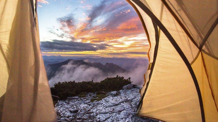
- A traditional 3-person dome tent weighs 2–3 kg. A quality ultralight shelter — Zpacks Duplex (a two-person DCF tarp-tent hybrid) weighs 430g. That single swap is a saving of 1.5–2.5 kg before you've changed anything else. The trade-off: ultralight shelters are less freestanding, require trekking poles to pitch, and offer less internal volume. For most conditions in three-season hiking, these are acceptable compromises.
- A quilt (no hood, no zip, sewn-footbox) replaces a mummy bag and can save 300–500g at equivalent temperature ratings. The Enlightened Equipment Enigma in 10°C rating weighs 400g. A comparable mummy bag typically weighs 700–900g. Quilts feel weird for the first night. Then they feel normal. Then you can't understand why you ever used a bag.
- A traditional 65L pack with a frame, hipbelt, and all the organizational compartments weighs 2–2.5 kg empty. A Hyperlite Mountain Gear 2400 pack weighs 534g at 38L capacity. You carry less because you pack less. This is circular until it isn't — until you realise that a lighter, frameless pack means you have already committed to bringing only what matters.
- reading
- river
- access
- ethics
- and
- the
- joy
- wild
- water
- lake
- district
- first
- time
- swam
- rather
- than
- pool
- was
- Adventure category: water.
- Location: Lake District, UK.
- The first time I swam in a river rather than a pool I was twenty-three and it was more frightening than I expected. Not because of any particular danger — it was a gentle stretch of the Wye in Herefordshire, shallow and clear — but because of the absence of control. No lane ropes. No tiles to count. No walls to reach. Just water moving somewhere it had decided to go long before I arrived, with no particular opinion about whether I was in it.
- That's the difference, and it's bigger than it sounds. Swimming in a pool is exercise. Swimming in a river is an encounter. The pool is predictable by design; the river is predictable only if you've learned how to read it, and even then it keeps reserves. What wild swimming asks of you — attention, humility, some willingness to be uncertain — is the same thing that every worthwhile outdoor activity asks. The water just makes it undeniable.
- Before you get in anywhere, you observe. A river tells you most of what you need to know if you look at it correctly. Here is what to look for:
- The legal position on wild swimming varies significantly by country and is frequently misunderstood. In Scotland, the Land Reform Act grants robust public access to most land and inland water for non-motorised activities. In England and Wales, the legal right to swim in rivers is narrower — you have a right of passage on some rivers but not all, and access to river banks often depends on separate landowner permission.
- "The river existed before you got there. Swim like a guest."
- Legal access and ethical access are related but not identical. Even where you have legal access, the obligations are clear: no littering, no fire, no damage to riverbanks, no washing with soap or chemicals that enter the water. These are minimum standards. Good wild swimming ethics go further: no blocking access for others, respect for fishing rights (many rivers are managed for angling and there are real conflicts), and awareness of the wildlife that uses the same water. Herons, otters, and kingfishers are all more easily disturbed than most people realise.
- Cold water is the subject of the largest gap between what people expect and what they experience. The expectation, shaped by years of reluctantly entering cold swimming pools, is that it will be unpleasant for a while and then fine. The reality — in water below 15°C — is more interesting than that.
- why
- cold
- routes
- demand
- warm
- minds
- winter
- mountaineering
- primer
- alpine
- swiss
- alps
- has
- reputation
- problem
- the
- people
- who
- Adventure category: winter-alpine.
- Location: Swiss Alps.
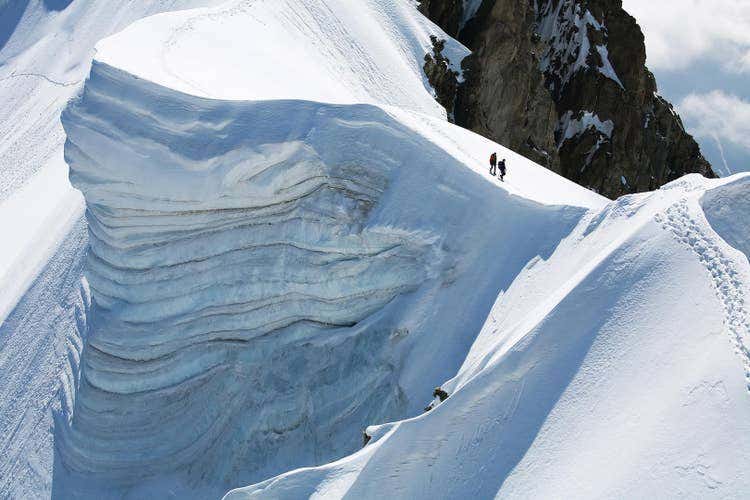
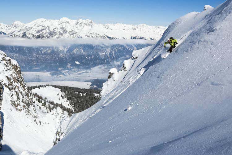
- Winter mountaineering has a reputation problem. The people who do it don't talk about it enough, and the people who write about it often make it sound like a form of self-punishment that only the pathologically stubborn can enjoy. Neither is accurate. Winter mountains are genuinely different from their summer versions — more demanding, more consequential, more beautiful in ways that don't photograph well — and understanding that difference is the beginning of doing it well.
- Three things change in winter that matter: consolidation, solitude, and consequence.
- Consolidation means that snow and ice create stable, predictable (though not safe) surfaces on terrain that in summer is loose scree and unstable rock. Many routes that are objectively unpleasant in summer — scrabbling over shifting stone — become clean and enjoyable with a proper freeze. This is why experienced winter mountaineers often prefer the harder season. The terrain behaves better when it's cold.
- Solitude is real and valuable. The same route that has a hundred people on it in July will have five in February. The mountain is the same mountain. What changes is the ratio of people to landscape, and with it, the quality of the experience.
- Consequence is the critical difference. Mistakes that are minor in summer — a slip, a navigation error, a late start — become serious in winter. The cold amplifies everything: injury risk, recovery time, the speed at which minor problems become emergencies. This is not an argument against going. It is an argument for going informed.
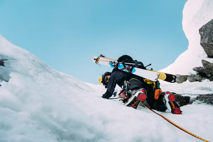
- A 60cm ice axe is the standard length for most alpine terrain. Longer axes are for glacier walking; shorter are for technical ice climbing. For general winter mountaineering, 60cm covers most situations. The skills to practice before you use one in earnest: the self-arrest (stopping a fall by driving the pick into snow) and the plunge arrest (using the spike as a brake on a descent). Both require practice in a controlled environment — a gentle snow slope with a runout — before you rely on them in the field.
- Twelve-point adjustable crampons fit most stiff-soled mountain boots. The key skill is putting them on correctly — every time, quickly, without looking down at your feet when you're on a slope — and understanding when to use them versus when to kick steps without them. As a general rule: if the slope would produce a serious fall if you slipped, put the crampons on. This is not a call for constant use. It is a call for honest assessment of what a slip would mean.
- first
- light
- the
- valley
- beginner
- guide
- yosemite
- climbing
- usa
- time
- drove
- into
- pulled
- over
- tunnel
- view
- and
- stood
- Adventure category: climbing.
- Location: Yosemite Valley, USA.
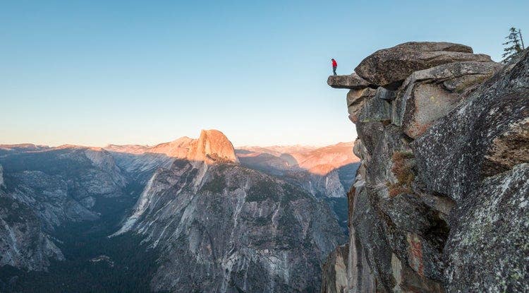
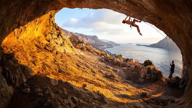
- The first time I drove into Yosemite Valley I pulled over at the Tunnel View and stood there for a long time doing nothing. El Capitan to the left. Half Dome straight ahead. Bridalveil Fall catching the morning light on the right. Every photograph you've ever seen of this place fails it in some fundamental way. The scale is something your brain has to recalibrate to experience.
- I'd been climbing at indoor gyms for eight months before that trip. I thought I was ready. I was not ready — at least not in the way I imagined. What I was ready for, it turned out, was exactly the right amount of humility to start learning something real.
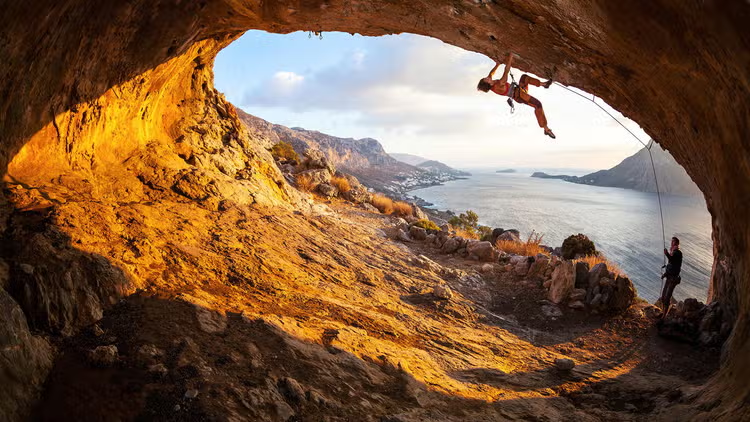
- Yosemite's climbing history is inseparable from American climbing's history. The big walls — El Cap, Half Dome, the Cathedral Spires — are where aid climbing and later free climbing were invented, refined, and pushed to their current extremes. That legacy hangs in the air. But the Valley has more than 3,000 documented routes, and a significant portion of them are accessible to people who are still figuring out how to clip a quickdraw without looking like they're fighting it.
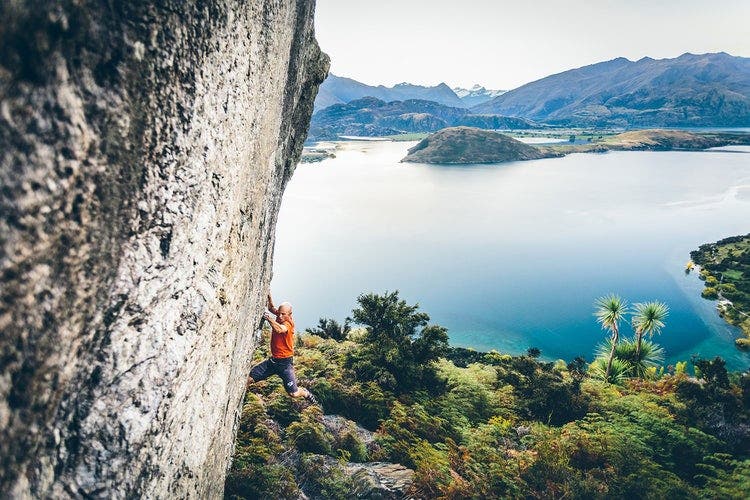
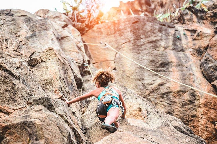
- The granite here is unlike anything you'll find indoors. It's coarse and unforgiving of sloppy footwork, but rewarding when you commit. Friction smears that look impossible hold body weight. Finger cracks that look like they should be simple will humble you within two moves. The stone has texture, character, and an opinion about whether you deserve to climb on it.
- Swan Slab sits near Camp 4 and is where most beginners find their footing. Routes like Guide Crack (5.6) and Grant's Crack (5.7) offer clean lines on solid granite. The grades feel sandbagged — "5.7" at Yosemite is not the same psychological experience as 5.7 at your gym. Don't let that discourage you. Let it recalibrate your scale. The rewards of moving cleanly on real rock, placing real gear, and building a real anchor are worth every moment of feeling slow and uncertain.
- The name does not inspire confidence. The climbing does. Manure Pile sits across the road from El Cap Meadow and hosts some of the most popular moderate multi-pitch routes in the Valley, including After Six (5.7) — a three-pitch route with a memorable hand crack that will teach you more about crack climbing in a single pitch than a month of gym sessions. Most routes here are well-bolted and well-traveled, which means you'll have company and beta if you get stuck.
- "Yosemite teaches you that rock doesn't care how confident you feel at the trailhead."
- ohrid
- city
- thousand
- churches
- perched
- the
- shores
- one
- europe
- oldest
- and
- deepest
- lakes
- that
- wears
- its
- history
- like
- Perched on the shores of one of Europe's oldest and deepest lakes, Ohrid is a city that wears its history like a crown. With over 365 churches — one for every day of the year, locals proudly say — cobblestone streets that climb toward a medieval fortress, and water so clear it shimmers turquoise in the afternoon sun, this small city in southwestern North Macedonia is one of the Balkans' most extraordinary destinations. It is a UNESCO World Heritage Site for both its natural and cultural values, and it earns that designation completely.
- I arrived on a Thursday evening in late May, stepping off a bus from Skopje into warm air that smelled of lake water and grilling fish. Within ten minutes of walking into the old town, I had already stopped three times to take photographs. Ohrid does that to you immediately.
- Ohrid's story stretches back more than 2,500 years. Known in antiquity as Lychnidos — meaning "city of light" — it was a prosperous settlement along the Via Egnatia, the great Roman road that connected the Adriatic to the Aegean. Coins, mosaics, and the remains of a Roman-era amphitheatre still surface across the hillsides, reminders that Ohrid has been a crossroads of civilisations for millennia. The theatre, which sat around 5,000 spectators, is still used today for summer concerts and performances — one of the few ancient venues in the Balkans that has retained a living cultural function.
- In the 9th century, Saints Clement and Naum, disciples of the Byzantine missionaries Cyril and Methodius, chose Ohrid as the base for their Slavic literary mission. Clement established a school here that is considered one of the first universities in Europe. More than 3,500 students were trained here in the Glagolitic and early Cyrillic alphabets, which were then spread across the entire Slavic world. For this reason alone, Ohrid holds a singular place in the cultural heritage of hundreds of millions of people — a fact the city wears with understated pride.
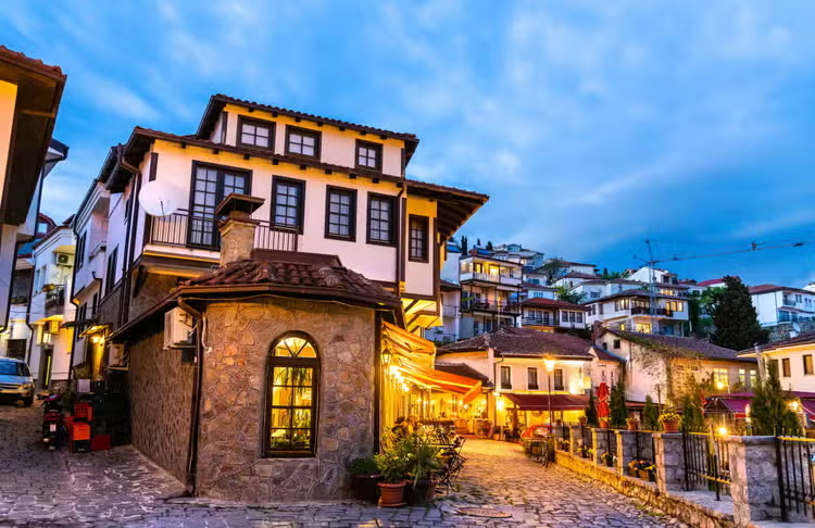
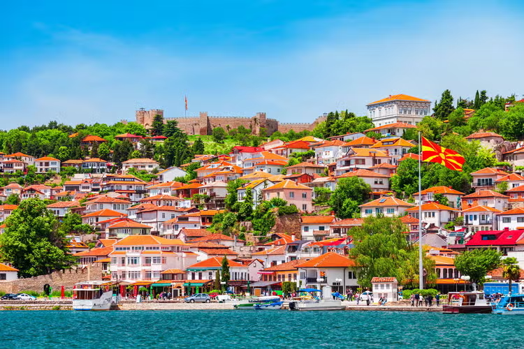
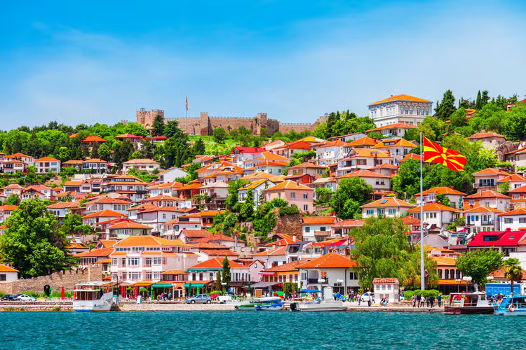
- Ohrid's old town climbs steeply from the lakefront through a maze of Ottoman-era timber houses toward Samuil's Fortress at the summit.
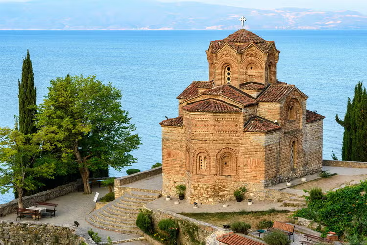
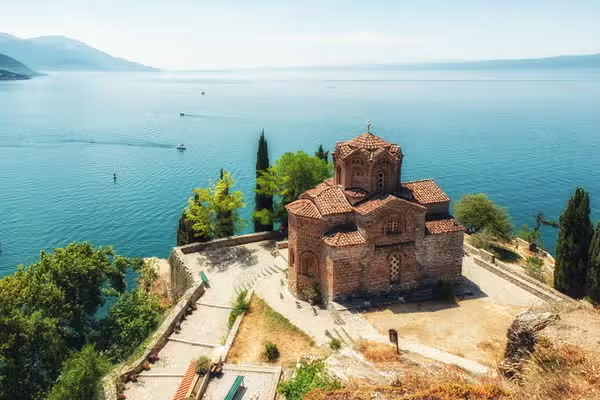
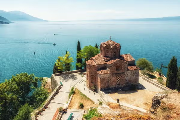
- No monument defines Ohrid more than its churches. The city and the surrounding region contain dozens of surviving Byzantine and medieval Orthodox churches, with frescoes that rival those of Constantinople. The most photographed is the Church of Saint John the Theologian at Kaneo, a 13th-century chapel balanced on a rocky promontory directly above the lake. It is, without exaggeration, one of the most beautifully positioned buildings in Europe. At sunset, when the limestone walls glow amber and the water below turns deep violet, it produces the kind of scene that makes you put the camera down and simply look.
- The Church of Saint Sophia, a large 11th-century cathedral in the lower town, is equally unmissable. Its interior walls are covered in remarkably preserved Byzantine frescoes — images of apostles, angels, and donors rendered in deep reds and blues that have survived nearly a thousand years. The building was converted to a mosque under Ottoman rule and then reconverted after independence; layers of whitewash were carefully removed in the 20th century to reveal the frescoes underneath, an archaeological act of extraordinary patience.
- ohrid
- adventure
- travel
- guide
- trekking
- kayaking
- balkan
- culture
- traveled
- not
- chasing
- adrenaline
- but
- something
- older
- the
- feeling
- standing
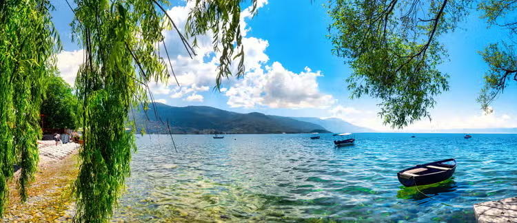
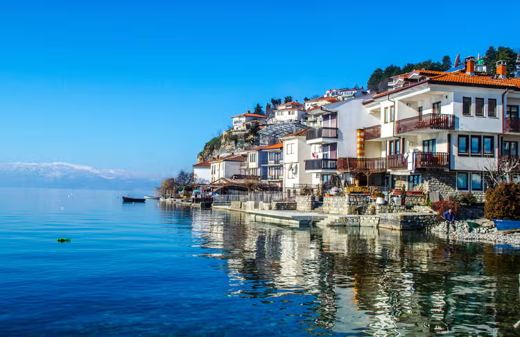
- We traveled to Ohrid not chasing adrenaline, but something older — the feeling of standing somewhere the modern world hasn't quite caught up to yet. Pre-dawn. A wooden boat on a lake so still it looks like glass. Above, the silhouette of a Byzantine church clinging to a cliff. Below, the oldest lake in Europe — home to species found nowhere else on Earth. The question that brought us here: how does a place this extraordinary remain this unknown?
- Ohrid is not just another European lake town. It is a convergence — of geological age, living culture, and genuine wilderness — that experienced adventure travellers are only now discovering. The lake — Ohridsko Ezero to the people who live on its shores — straddles North Macedonia and Albania across 288 km² of surface water that reaches 288 metres at its deepest point. It has been continuously inhabited since the Neolithic era. The Byzantine empire left its mark in churches and frescoes. The Ottoman period left it in architecture and food. None of it cancels the others; Ohrid is a place where everything coexists without effort.
- While Croatia and Slovenia dominate Balkan adventure travel coverage, Ohrid remains conspicuously absent from mainstream adventure media — even as it outperforms on every metric that matters to this kind of traveller: trail diversity, cultural density, water clarity, and affordability. We went to find out if that quiet reputation is deserved. It is.
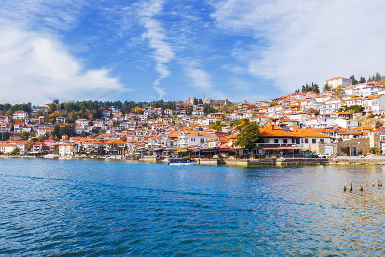
- The old town rises from the lake on a peninsula of cobblestone and limestone, dense enough to feel medieval but open enough to breathe. Fortress walls from the Tsar Samuel era — 10th century, still mostly intact — frame the upper quarter. Below them, narrow streets descend past carpenter workshops, family-run restaurants, and churches that have been in continuous use for seven hundred years. The smell is fresh water and pine from the mountains above, coffee from open doorways, woodsmoke in the evening.
- First impressions tend toward disorientation — not unpleasant. Ohrid operates at a pace that rewards slowing down. The kind of place where the light changes what you see every hour, and where you find yourself returning to the same view at different times of day to catch what you missed.
- The Church of St. John at Kaneo — 13th century, perched on a cliff of orange limestone above the lake — at the hour when the light arrives from the east.
- Galichica National Park forms the mountain spine on the eastern shore, running along the border with Albania and offering some of the most underrated hiking terrain in the southern Balkans. The park has more than 40 marked trails ranging from half-day valley walks to the demanding 3-day ridge traverse that crosses the range at altitude and descends to the Albanian shore of Lake Prespa on the far side.
- ohrid
- where
- three
- million
- year
- old
- lake
- meets
- the
- mountains
- older
- than
- almost
- any
- earth
- somewhere
- between
- two
- Lake Ohrid is older than almost any lake on Earth — somewhere between two and three million years — and it shows in the clarity of the water and the depth of the culture on its shores.
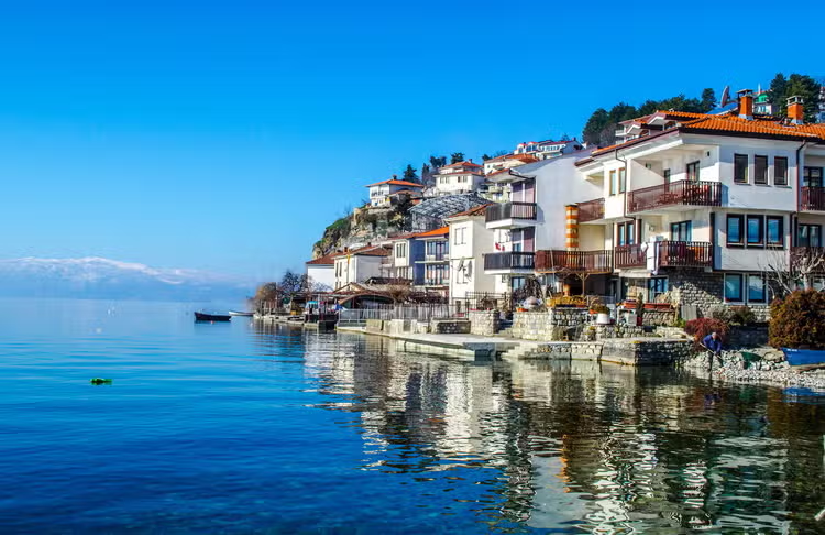
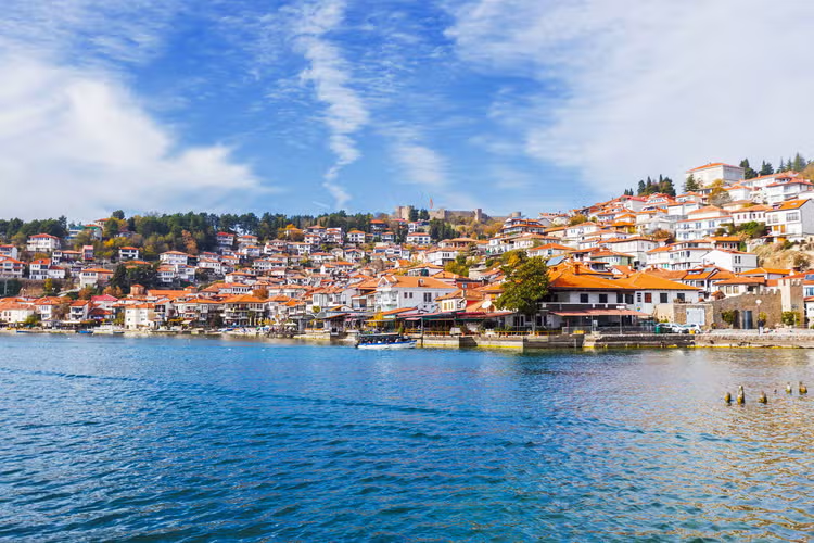
- The town stacks white-walled, red-roofed houses up a hillside above the water, crowned by Samuel's Fortress and edged by the cliff-top Church of St. John at Kaneo, one of the most photographed churches in the Balkans.
- Mornings are for the water — swim, kayak, or take a boat along the shore to Kaneo, where the 13th-century church sits on a rocky promontory over impossibly blue water.
- Afternoons belong to the old town's lanes, the ancient theatre, and the layered monasteries that earned Ohrid its dual UNESCO listing for both culture and nature.
- "A swimmable UNESCO lake, a walkable old town, and Balkan mountains at your back — Ohrid is a rare combination of relaxation, heritage, and accessible adventure."
- This is WKND's flagship culture-meets-lake-adventure trip: approachable for first-time Balkan travellers, rich enough for repeat WKND community members, and flexible enough to layer in hiking and climbing for more active segments.
- What makes Ohrid unusual is how quickly the day can change character. The same morning that begins with a swim off the old town can end on a ridge in Galičica National Park, the long green spine of mountains that rises behind Lake Ohrid. Trails climb out of the lakeside villages and into open highland where the water spreads out far below, and the descent drops you back among the lanes and cafés by evening — a rare place where lake and mountain sit within a single day’s reach.
- the
- mekong
- delta
- paddling
- into
- vietnam
- living
- river
- world
- alarm
- goes
- off
- 15am
- and
- for
- moment
- you
- can
- The alarm goes off at 4:15am and for a moment you can't remember why you set it so early. Then you hear the river. The low thrum of longtail boat engines warming up in the dark, the metallic clink of produce being loaded onto wooden hulls, the distant call of a vendor whose day started an hour before yours. You are in Can Tho, and the Mekong Delta is already at work.
- The Mekong Delta is a 40,000 km² river labyrinth in southern Vietnam — nine distributaries of the Mekong River spreading out across the flood plain before reaching the South China Sea. Known locally as Cửu Long, the Nine Dragons, it is home to approximately 17 million people whose lives revolve entirely around the water. Floating markets, canal-side rice paddies, fruit orchards, coconut groves, and boat-based commerce that has changed little in generations.
- Most travelers treat the delta as a one-day excursion from Ho Chi Minh City. A bus, a boat, lunch on the river, back by dinner. The version they see is real — and it is genuinely good. But the version that stays with you is only accessible to people who stay. WKND goes deeper — sleeping in riverside villages, paddling the smaller canals at dawn before the tour groups arrive, joining community-led market tours that give you genuine access to a world the day-trippers never reach.
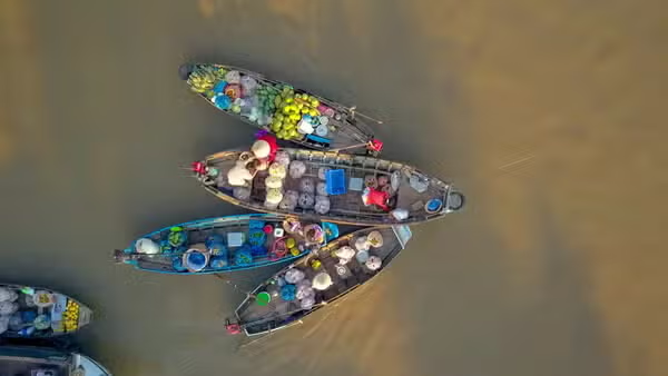
- The Cai Rang floating market is Vietnam's largest, and the advice to arrive early is repeated so often it has become a cliché. The thing is, it's true — and "early" means something more extreme than you might expect. We arrived at 5am thinking we were ahead of the crowds. The market had been running for three hours.
- By first light, hundreds of wooden boats were clustered on the river, their hulls low under the weight of watermelons, dragonfruit, pineapples, and bundles of morning glory. The sellers wear conical hats and most transactions are conducted without words — prices established through some combination of proximity, eye contact, and a practice refined over decades. You don't browse the Cai Rang market. You read it.
- The best access is by small motorboat from Can Tho's riverside district, departing before 5am to catch the market at its most active. By 8am, the density begins to thin. By 10am, it's essentially over. Plan accordingly.
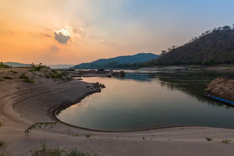
- The Mekong's most rewarding experiences aren't on the main river. They're in the narrow side canals — kênh — that wind through coconut groves, past stilted houses, and into the rhythms of daily life that tourism hasn't reached yet.
- ladakh
- india
- where
- the
- sky
- meets
- earth
- 000
- metres
- there
- moment
- usually
- second
- morning
- leh
- when
- altitude
- releases
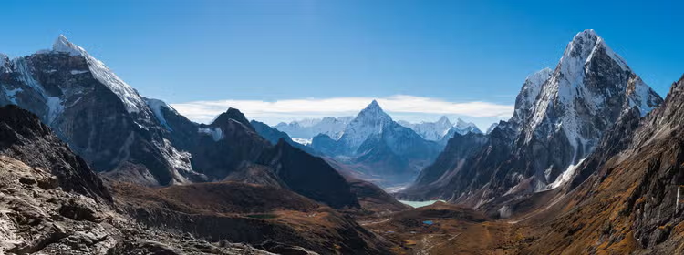
- There is a moment, usually on the second morning in Leh, when the altitude releases its grip and the world comes into focus. The sky above is a blue that doesn't exist at sea level. The mountains are bare — no forest, no softening of any kind — and they go on in every direction without apology. Ladakh does not ease you in. It simply reveals itself, and what it reveals is unlike anywhere else on earth.
- Ladakh is technically a cold desert. Lying in the rain shadow of the Himalayas, it receives less than 100 mm of precipitation per year, yet glacial rivers carve through the stone and sustain villages and monasteries that have stood for a thousand years. The result is a landscape of brutal contrasts: sand dunes in Nubra Valley backed by 6,000-metre peaks; Pangong Lake — 134 km long, 4,250 m above sea level — shifting between turquoise, cobalt, and silver as clouds move across the Tibetan plateau.
- The Markha Valley trek is Ladakh's definitive wilderness route. Six days, 78 km, two major high passes — Ganda La at 4,900 m and Kongmaru La at 5,200 m. The trail runs through the heart of Hemis National Park, passing isolated villages of stone houses with painted window frames, ancient gompas perched on impossible cliff faces, and open grazing grounds where yaks and Bactrian horses roam untended. There is no cell service for most of the route. That is entirely the point.
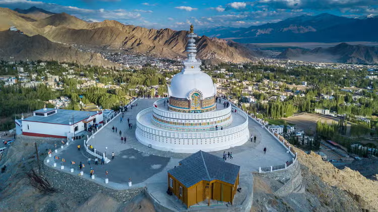
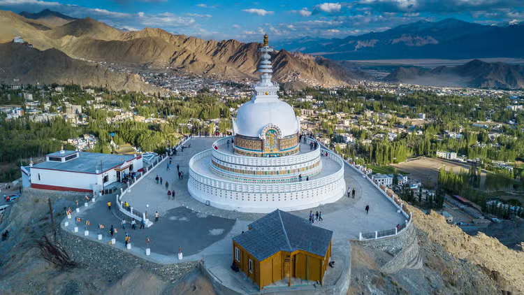
- Buddhism arrived in Ladakh in the 2nd century CE and has shaped every aspect of life since. Hemis Monastery — the largest in Ladakh — hosts its annual festival in June and July: two days of masked cham dances in the courtyard, silk thangkas unfurled from the upper gallery, monks in robes of deep red and gold. Thiksey Gompa rises in twelve storeys from its hilltop like a Tibetan Potala. The Shanti Stupa above Leh catches the last light of every evening in white stone. These are not tourist attractions bolted onto a landscape — they are the landscape.
- September is when Ladakh becomes a photographer's obsession. The monsoon has cleaned the air. The willows along the Indus have turned yellow and orange. Visitors have thinned out. At dawn, Pangong Lake is absolutely still and the light is horizontal and orange, and there is nothing between you and the reflection of the mountains in the water. At Diskit in Nubra Valley, a 32-metre Maitreya Buddha looks out over sand dunes and apricot orchards with the Karakoram as a backdrop. Ladakh does not offer ordinary frames.
- Inner Line Permit required for Nubra Valley, Pangong Lake, Tso Moriri — apply online 4 weeks ahead
- Mandatory 48 hours acclimatisation in Leh before any trekking or high-altitude driving
- what
- fitness
- level
- your
- adventures
- assume
- honest
- skip
- leg
- day
- varies
- wildly
- and
- refuse
- pretend
- moderate
- means
- the
- It varies wildly, and we refuse to pretend "moderate" means the same thing on a Patagonian haul as on a Sunday stroll with a latte. Each author says what the route actually felt like in their body — lungs, knees, ego, the whole package. Read the intro; if they mention "we bonked at hour four," that's a feature, not a typo.
- can
- these
- routes
- alone
- will
- mum
- worry
- your
- regardless
- that
- her
- job
- ours
- flag
- when
- solo
- genuinely
- bad
- Your mum will worry regardless — that's her job. Ours is to flag when solo is a genuinely bad idea (crevasses, tide races, things that go "whoosh" in the night). Many pieces are solo-friendly; others basically say "bring a friend who knows what they're doing." We spell it out so you can text your mum something reassuring and still be honest with yourself.
- how
- fresh
- this
- intel
- snow
- melts
- opinions
- don
- trip
- dates
- sit
- loud
- and
- proud
- the
- byline
- nature
- meanwhile
- Trip dates sit loud and proud in the byline. Nature, meanwhile, enjoys changing its mind without updating the website. For snow, surf, and anything involving the word "alpine," double-check the official source before you pack the wrong jacket and blame us in a one-star review. We refresh pieces when readers send credible "actually, the bridge is gone" notes.
- where
- the
- gear
- need
- excuse
- buy
- something
- orange
- section
- sorted
- activity
- you
- can
- justify
- that
- thing
- honestly
- affiliate
- The Gear section is sorted by activity so you can justify that orange thing honestly. No affiliate links — we make zero cents when you click, which is either noble or foolish depending on your accountant. Articles usually tuck a kit list into the route notes for people who read the fine print.
- you
- run
- guided
- trips
- bring
- snacks
- love
- still
- won
- guide
- wknd
- magazine
- not
- tour
- company
- matching
- fleeces
- walkie
- We love snacks; we still won't guide you. WKND is a magazine, not a tour company — no matching fleeces, no walkie-talkie choreography. Use Expeditions for big-trip inspiration, then plan it yourself like the beautifully chaotic adult you are.
- how
- find
- something
- close
- couch
- the
- destinations
- page
- your
- map
- farther
- than
- but
- you
- choose
- much
- got
- depth
- The Destinations page is your map of "farther than the couch, but you choose how much." We've got depth in Patagonia, Scandinavia, the Alps, California, and Southeast Asia — and oddballs everywhere else. Don't see your backyard? Tell us. Worst case we daydream; best case we commission someone to go suffer for art.
- how
- submit
- reader
- story
- without
- summoning
- demon
- stories
- wknd
- adventures
- com
- with
- the
- subject
- submission
- route
- Email stories@wknd-adventures.com with the subject Reader Submission: [route name]. Attach Word, Google Doc link, or plain text — we're not precious. Add at least one photo (blurry summit selfies welcome if the story slaps) and a one-line bio so we know you're human. That's the whole ritual.
- what
- makes
- story
- publishable
- cool
- trip
- bro
- want
- the
- version
- you
- tell
- after
- third
- coffee
- when
- your
- friend
- We want the version you tell after the third coffee when your friend says "wait, then what happened?" A specific screw-up, a real decision, a detail that couldn't be invented in an office. Polished prose is optional; verifiable chaos is not. If you climbed Everest in perfect weather with zero feelings, we'll nap politely.
- you
- pay
- contributors
- asking
- for
- landlord
- not
- yet
- small
- indie
- and
- funded
- like
- very
- committed
- hobby
- get
- credit
- Not yet — we're small, indie, and funded like a very committed hobby. You get credit, a bio, and us yelling about your piece on the internet. No free boots in exchange for your soul, either. When we can pay properly, we'll shout it from a mountain; until then, blame capitalism, not your editor.
- can
- send
- only
- photos
- and
- vibes
- don
- rasterize
- well
- the
- images
- plus
- 300
- 400
- words
- what
- looking
- why
- Vibes don't rasterize well. Send the images plus 300–400 words on what we're looking at and why it mattered. If the frames are absurdly good, we'll help you shape the words — we're editors, not monsters. Photo essays need ~6 bangers and one clear idea, not sixty near-duplicates of the same ridge.
- how
- long
- until
- hear
- back
- refreshed
- inbox
- 400
- times
- batch
- read
- once
- month
- aim
- for
- answer
- within
- six
- We batch-read once a month; aim for an answer within six weeks — yes, no, or "not quite, here's why." We don't ghost; we're just slow in a charming, artisanal way. Past eight weeks? Nudge us. We probably buried your email under a pile of "RE: RE: tent warranty."
- can
- repost
- piece
- blog
- that
- three
- people
- read
- after
- six
- months
- yes
- anywhere
- you
- like
- with
- line
- ran
- After six months, yes — anywhere you like, with a line that it ran here first. We keep it on our site because the internet is forever and we're sentimental. You still own your words; we just asked for a respectful head start, like letting someone finish their sandwich before you steal a fry.
- this
- route
- within
- ability
- main
- character
- syndrome
- ignore
- the
- average
- daydream
- find
- spiciest
- bit
- one
- scary
- pitch
- whiteout
- Ignore the average daydream — find the spiciest bit of the route (one scary pitch, one whiteout nav leg, one "why is this wet") and ask if you've done that flavour of spicy before, for real, not on YouTube. Grades assume you already speak the language: Scottish winter III assumes crampons aren't a fashion statement. Read recent trip reports; trust the grumpy ones slightly more than the Instagram captions.
- solo
- overnight
- what
- actually
- need
- besides
- optimism
- shelter
- and
- sleep
- stuff
- rated
- for
- weather
- one
- notch
- worse
- than
- Shelter and sleep stuff rated for weather one notch worse than the forecast (forecasts lie; you knew that). Map, compass, offline map on something charged, water treatment, food plus an extra meal for when you miss the trail so hard you invent new swear words, basic first aid + foil blanket, and a PLB or satellite messenger — because "I'll have signal" is not a plan, it's a punchline. Optimism packs lighter than a tent; bring the tent anyway.
- hot
- ticket
- permits
- need
- five
- alarms
- and
- spreadsheet
- yes
- famous
- routes
- open
- bookings
- like
- concert
- tickets
- set
- calendar
- Yes. Famous routes open bookings like concert tickets — set a calendar alert, caffeinate responsibly, and click at go-time. Lotteries: use every legal entry you're allowed. Missed the window? Shoulder season is often prettier, cheaper, and less crowded, and rangers sometimes have walk-up fairy dust. Your spreadsheet can be named "Dreams.xlsx" if it helps emotionally.
- the
- weather
- turned
- push
- through
- like
- movie
- montage
- montages
- skip
- boring
- part
- where
- someone
- gets
- hypothermia
- before
- you
- Montages skip the boring part where someone gets hypothermia. Before you leave, pick concrete turn-around triggers — wind over X, snowfall rate Y, "if we're not at the col by Z o'clock." Decisions made in a warm kitchen beat decisions made while hangry above the treeline. The mountain will still be there; your knees prefer you sensible.
- why
- hire
- local
- guide
- when
- watched
- minute
- tutorial
- because
- the
- doesn
- know
- today
- serac
- mood
- which
- bush
- trail
- Because the tutorial doesn't know today's serac mood, which bush the trail hides behind after the storm, or how to not be a jerk on someone else's land. Hiring locally isn't admitting defeat — it's buying decades of "we don't talk about that gully" knowledge. Look up IFMGA / AMGA / NZMGA (or your country's equivalent) and pick a human, not an algorithm.
- how
- you
- pick
- difficulty
- dartboard
- vibes
- science
- use
- real
- systems
- uiaa
- french
- grades
- scottish
- adjectives
- ski
- touring
- codes
- We use real systems — UIAA, French grades, Scottish adjectives, ski-touring codes — because inventing "WKND Level 7 spicy" helps nobody. When guidebooks disagree (they love that), we say so and add what the grade feels like in human verbs: "lots of front-pointing," "runouts that encourage philosophy." A number without context is just typography.
- how
- often
- you
- update
- routes
- every
- full
- moon
- patch
- things
- when
- someone
- credible
- emails
- the
- bridge
- now
- concept
- We patch things when someone credible emails "the bridge is now a concept" or similar. Article headers show original date plus last refresh. Seasonal routes get a nudge toward official condition pages because we're writers, not wizards. If a piece is old enough to drive in some countries, verify the beta yourself before you blame us for your soggy socks.
- are
- these
- gear
- links
- secretly
- funding
- your
- espresso
- habit
- nope
- zero
- affiliate
- buy
- this
- and
- get
- three
- cents
- Nope — zero affiliate links, zero "buy this and we get three cents." Espresso is funded the old-fashioned way: denial and hope. If we ever flipped that policy, we'd announce it loudly so you could throw popcorn. Recommendations come from use in the field, not from a brand deck.
- what
- does
- contributor
- verified
- mean
- they
- pinky
- swore
- means
- named
- human
- stood
- the
- route
- within
- months
- and
- checked
- It means a named human stood on the route within ~18 months and checked the boring stuff — huts, permits, "is that trail still there" — against reality, not a photocopied guide from 1997. It is not a guarantee the glacier didn't move overnight; it is a promise someone put their reputation on the line for that date stamp.
- write
- like
- text
- message
- that
- disqualifying
- most
- are
- route
- nerds
- first
- comma
- negotiators
- second
- you
- were
- there
- and
- Most of us are route nerds first, comma negotiators second. If you were there and you're honest about the mud, we can help with the semicolons. We can't invent your experience from thin air; we can absolutely sand the rough edges off how you tell it. Send the messy draft — perfection is overrated and suspicious.
- paycheck
- exposure
- bucks
- right
- now
- real
- bylines
- audience
- imaginary
- dollars
- sneaky
- pay
- you
- headlamps
- deals
- either
- when
- can
- Right now: real bylines, real audience, imaginary dollars. No sneaky "we'll pay you in headlamps" deals either. When we can pay real money, we'll make noise about it — think less "quiet policy update," more "we bought cake." Until then, thanks for feeding the culture anyway.
- trip
- was
- beautiful
- disaster
- still
- story
- that
- the
- good
- stuff
- wrong
- valley
- thunderstorm
- tantrum
- summit
- stayed
- hypothetical
- readers
- That's the good stuff. Wrong valley, thunderstorm tantrum, summit that stayed hypothetical — readers learn more from your bad day than from another hero shot. Give us the moment you knew, what you knew (and didn't), and what you'd pack differently besides regret. Comedy optional; humility appreciated.
- pictures
- only
- pitch
- like
- silent
- film
- but
- with
- jpegs
- for
- field
- notes
- photo
- essays
- want
- eight
- frames
- that
- For Field Notes photo essays we want eight+ frames that sequence like a story, plus 200–300 words so we're not guessing your plot. Send five samples and a teaser; if it's magic, we'll nag you gently for the rest. Random pretty clouds: lovely, not a narrative.
- wknd aero
- aero
- flights
- flight
- airport
- ohd
- booking
- flight experience
- ohrid
- north macedonia
- lake
- heritage
- WKND Aero links Ohrid lakeside adventure to its flight finder. Destination airport listed by Aero: OHD.
- The published Aero starting flight fare is from $449; this is a from-fare label, not an origin/date-specific quote or a complete trip cost.
- Aero experience page: https://main--wknd-aero--znikolovski.aem.live/adventures/ohrid-macedonia
- Find flights for destination OHD and adventure ohrid-macedonia: https://main--wknd-aero--znikolovski.aem.live/book/flights?dest=OHD&adv=ohrid-macedonia
- Original WKND Adventures field notes: https://main--masterclass-demo--znikolovski.aem.live/blog/ohrid-macedonia
- The Aero experience page does not specify a departure origin, travel dates or seat availability. Its starting flight fare is not a full adventure budget and does not establish that accommodation, guides, transfers or activities are included. Check the linked flight finder for current options and final pricing.
- wknd aero
- aero
- flights
- flight
- airport
- fat
- booking
- flight experience
- yosemite
- granite
- climbing
- california
- WKND Aero links Yosemite granite climbing to its flight finder. Destination airport listed by Aero: FAT.
- The published Aero starting flight fare is from $349; this is a from-fare label, not an origin/date-specific quote or a complete trip cost.
- Aero experience page: https://main--wknd-aero--znikolovski.aem.live/adventures/yosemite-rock-climbing
- Find flights for destination FAT and adventure yosemite-rock-climbing: https://main--wknd-aero--znikolovski.aem.live/book/flights?dest=FAT&adv=yosemite-rock-climbing
- Original WKND Adventures field notes: https://main--masterclass-demo--znikolovski.aem.live/blog/yosemite-rock-climbing
- The Aero experience page does not specify a departure origin, travel dates or seat availability. Its starting flight fare is not a full adventure budget and does not establish that accommodation, guides, transfers or activities are included. Check the linked flight finder for current options and final pricing.
- wknd aero
- aero
- flights
- flight
- airport
- eve
- booking
- flight experience
- lofoten
- norway
- arctic
- surfing
- WKND Aero links Lofoten Arctic surfing to its flight finder. Destination airport listed by Aero: EVE.
- The published Aero starting flight fare is from $749; this is a from-fare label, not an origin/date-specific quote or a complete trip cost.
- Aero experience page: https://main--wknd-aero--znikolovski.aem.live/adventures/kayaking-norway
- Find flights for destination EVE and adventure kayaking-norway: https://main--wknd-aero--znikolovski.aem.live/book/flights?dest=EVE&adv=kayaking-norway
- Original WKND Adventures field notes: https://main--masterclass-demo--znikolovski.aem.live/blog/kayaking-norway
- The Aero experience page does not specify a departure origin, travel dates or seat availability. Its starting flight fare is not a full adventure budget and does not establish that accommodation, guides, transfers or activities are included. Check the linked flight finder for current options and final pricing.
- wknd aero
- aero
- flights
- flight
- airport
- puq
- booking
- flight experience
- patagonia
- chile
- w circuit
- trekking
- WKND Aero links Patagonia W Circuit trekking to its flight finder. Destination airport listed by Aero: PUQ.
- The published Aero starting flight fare is from $899; this is a from-fare label, not an origin/date-specific quote or a complete trip cost.
- Aero experience page: https://main--wknd-aero--znikolovski.aem.live/adventures/patagonia-trek
- Find flights for destination PUQ and adventure patagonia-trek: https://main--wknd-aero--znikolovski.aem.live/book/flights?dest=PUQ&adv=patagonia-trek
- Original WKND Adventures field notes: https://main--masterclass-demo--znikolovski.aem.live/blog/patagonia-trek
- The Aero experience page does not specify a departure origin, travel dates or seat availability. Its starting flight fare is not a full adventure budget and does not establish that accommodation, guides, transfers or activities are included. Check the linked flight finder for current options and final pricing.
- wknd aero
- aero
- flights
- flight
- airport
- ixl
- booking
- flight experience
- ladakh
- india
- himalayas
- trekking
- WKND Aero links Ladakh Himalayan trekking to its flight finder. Destination airport listed by Aero: IXL.
- The published Aero starting flight fare is from $899; this is a from-fare label, not an origin/date-specific quote or a complete trip cost.
- Aero experience page: https://main--wknd-aero--znikolovski.aem.live/adventures/ladakh-india
- Find flights for destination IXL and adventure ladakh-india: https://main--wknd-aero--znikolovski.aem.live/book/flights?dest=IXL&adv=ladakh-india
- Original WKND Adventures field notes: https://main--masterclass-demo--znikolovski.aem.live/blog/ladakh-india
- The Aero experience page does not specify a departure origin, travel dates or seat availability. Its starting flight fare is not a full adventure budget and does not establish that accommodation, guides, transfers or activities are included. Check the linked flight finder for current options and final pricing.
- patagonia
- w circuit
- torres del paine
- gear checklist
- packing
- route briefing
- permits
- access
- camping
- refugios
- Trip planning: Patagonia W Circuit. Gear checklist: The field party carried waterproof hard-shell jacket and trousers, gaiters, and trekking poles for wet and windy conditions.
- Trip planning: Patagonia W Circuit. Gear checklist: Their camping kit included a tent and cold-weather sleeping bag; the report describes tent problems in strong gusts, not a guarantee that this kit suits every trip.
- Trip planning: Patagonia W Circuit. Gear checklist: A water filter and a dry bag for electronics and documents appear in the published packing list.
- Trip planning: Patagonia W Circuit. Gear checklist: The report recommends testing zips, clasps, and buckles before departure after a sleeping-bag zip failed during the trek.
- Trip planning: Patagonia W Circuit. Gear checklist: Foot-care supplies and an offline W Circuit map were part of their preparation; do not rely on mobile coverage.
- Trip planning: Patagonia W Circuit. Route briefing: This is the authors' nine-day W Circuit account, not a fixed itinerary for every traveller.
- Trip planning: Patagonia W Circuit. Route briefing: Days 1-2 cover arrival from Puerto Natales via Laguna Amarga and the Torres mirador climb.
- Trip planning: Patagonia W Circuit. Route briefing: Days 3-4 describe the French Valley; days 5-6 reach Grey Glacier; days 7-9 cover the return and walk out.
- Trip planning: Patagonia W Circuit. Route briefing: The report describes frequent rain and strong winds. Exact daily distances, elevations, and current trail closures are not supplied.
- Trip planning: Patagonia W Circuit. Permits & access: Puerto Natales is the report's staging town, with gear rental, supplies, and a bus connection to the park.
- Trip planning: Patagonia W Circuit. Permits & access: The report describes a park reservation system and refugio nights booked months ahead. Verify current entry and overnight booking requirements before committing.
- Trip planning: Patagonia W Circuit. Permits & access: Use the park's current information to check permitted campsites and the operators serving your chosen route; the article is not a booking confirmation.
- Trip planning: Patagonia W Circuit. Source limitations: Historical field report, not current availability. Its camping and equipment descriptions are inconsistent in places; confirm equipment and overnight requirements directly with the park.
- Trip planning: Patagonia W Circuit. Read the Patagonia field notes: https://main--masterclass-demo--znikolovski.aem.live/blog/patagonia-trek
- Trip planning: Patagonia W Circuit. Check Torres del Paine park information: https://parquetorresdelpaine.cl/
- yosemite
- yosemite valley
- climbing
- gear checklist
- packing
- route briefing
- permits
- access
- camp 4
- swan slab
- Trip planning: Yosemite climbing. Gear checklist: The report's equipment list includes a helmet, harness, belay device, compatible rope, and locking carabiner.
- Trip planning: Yosemite climbing. Gear checklist: Quickdraws and traditional protection are described for different route types; have a qualified instructor confirm the equipment for the actual route.
- Trip planning: Yosemite climbing. Gear checklist: Climbing shoes, an approach pair, chalk, and sun protection appear in the field notes.
- Trip planning: Yosemite climbing. Gear checklist: A small crag pack carries water, snacks, a rain layer, first aid, and a guidebook or downloaded topo.
- Trip planning: Yosemite climbing. Gear checklist: This editorial list is not instruction in belaying, anchor building, or rope systems.
- Trip planning: Yosemite climbing. Route briefing: The source is a beginner's Yosemite Valley field guide, not a day-by-day expedition itinerary.
- Trip planning: Yosemite climbing. Route briefing: Swan Slab near Camp 4 is the author's starting area, with discussion of granite footwork and crack-climbing technique.
- Trip planning: Yosemite climbing. Route briefing: Manure Pile Buttress appears as a moderate multi-pitch option, not a recommendation to attempt it without suitable experience.
- Trip planning: Yosemite climbing. Route briefing: The article encourages starting small and taking instruction before climbing outdoors; current route topos and protection details need separate verification.
- Trip planning: Yosemite climbing. Permits & access: Consult National Park Service climbing guidance for current rules, closures, and any activity-specific permits.
- Trip planning: Yosemite climbing. Permits & access: Check the official Camp 4 page for the current reservation process and campsite availability.
- Trip planning: Yosemite climbing. Permits & access: The article's seasonal entry and first-come camping descriptions are historical; do not treat them as today's booking rules.
- Trip planning: Yosemite climbing. Source limitations: Route-specific protection and skills must be checked with a qualified instructor. The field notes do not establish current access, reservation availability, or a complete safe climbing kit.
- Trip planning: Yosemite climbing. Read the Yosemite field notes: https://main--masterclass-demo--znikolovski.aem.live/blog/yosemite-rock-climbing
- Trip planning: Yosemite climbing. Check NPS climbing information: https://www.nps.gov/yose/planyourvisit/climbing.htm
- Trip planning: Yosemite climbing. Check Camp 4 reservations: https://www.nps.gov/yose/planyourvisit/camp4.htm
- lofoten
- unstad
- arctic surfing
- cold water
- gear checklist
- packing
- route briefing
- permits
- access
- norway
- Trip planning: Lofoten Arctic surfing. Gear checklist: The author's Arctic surf kit includes a hooded wetsuit, gloves, and boots suited to cold water; ask the local provider to assess conditions and fit.
- Trip planning: Lofoten Arctic surfing. Gear checklist: A changing mat, dry robe, dry clothes, and a thermos support the report's sheltered before-and-after-session routine.
- Trip planning: Lofoten Arctic surfing. Gear checklist: Spare fins, a fin key, and board protection appear in the published kit list.
- Trip planning: Lofoten Arctic surfing. Gear checklist: The article names Yr.no and Windguru as forecast references, to be combined with local knowledge rather than used alone.
- Trip planning: Lofoten Arctic surfing. Gear checklist: Its remote-coast kit includes first aid and an emergency blanket; equipment does not eliminate cold-water or tidal hazards.
- Trip planning: Lofoten Arctic surfing. Route briefing: This is a surf-area briefing centred on Unstad, not a kayaking itinerary despite the legacy URL.
- Trip planning: Lofoten Arctic surfing. Route briefing: The article contrasts Unstad with Eggum and Flakstad; break choice depends on swell, wind, daylight, and local conditions.
- Trip planning: Lofoten Arctic surfing. Route briefing: Its autumn and winter account describes limited daylight and cold water, with more variable summer surf.
- Trip planning: Lofoten Arctic surfing. Route briefing: Offshore reefs and tidal passages are not self-guided recommendations; the report stresses current local knowledge.
- Trip planning: Lofoten Arctic surfing. Permits & access: The report describes access via Bodo and onward ferry or road travel; check the actual service and route for your dates.
- Trip planning: Lofoten Arctic surfing. Permits & access: A car helps reach dispersed breaks; the article notes that public bus access is less flexible.
- Trip planning: Lofoten Arctic surfing. Permits & access: The source does not establish a blanket surf-permit exemption or current parking and access rules. Confirm arrangements with local providers and visitor information.
- Trip planning: Lofoten Arctic surfing. Source limitations: Cold-water equipment examples are not a safety guarantee. Confirm suitability, access, forecasts, and session plans with qualified local surf providers.
- Trip planning: Lofoten Arctic surfing. Read the Lofoten field notes: https://main--masterclass-demo--znikolovski.aem.live/blog/kayaking-norway
- Trip planning: Lofoten Arctic surfing. Check Lofoten visitor information: https://visitlofoten.com/en/
- ohrid
- galicica
- galichica
- lake ohrid
- gear checklist
- packing
- route briefing
- permits
- access
- north macedonia
- Trip planning: Ohrid lake and mountains. Gear checklist: The companion Ohrid travel guide lists trekking poles, sunscreen, and a waterproof layer for hiking preparation.
- Trip planning: Ohrid lake and mountains. Gear checklist: Swimwear and a camera appear in its mixed lake-and-culture packing list; equipment needs differ between walking and water activities.
- Trip planning: Ohrid lake and mountains. Gear checklist: The article calls for preparation and navigation skills for longer Galicica traverses rather than treating them as casual old-town walks.
- Trip planning: Ohrid lake and mountains. Gear checklist: The lakeside notes recommend carrying a passport for ranger and border checks; confirm the documents required for your nationality and itinerary.
- Trip planning: Ohrid lake and mountains. Route briefing: Combine lakeside and old-town visits with separate hiking time in Galicica; this is flexible trip context, not a booked itinerary.
- Trip planning: Ohrid lake and mountains. Route briefing: Kaneo, Samuel's Fortress, the ancient theatre, and the monasteries feature in the heritage portion.
- Trip planning: Ohrid lake and mountains. Route briefing: The companion guide describes Velestovo as an introductory hiking option and longer ridge traverses as more demanding.
- Trip planning: Ohrid lake and mountains. Route briefing: The published reports favour late spring and September for different activities, but current trail and lake conditions still need checking.
- Trip planning: Ohrid lake and mountains. Permits & access: The source identifies Ohrid Airport and road access from Skopje; transfer duration and seasonal services must be checked for your dates.
- Trip planning: Ohrid lake and mountains. Permits & access: Consult Galicica National Park for current trail access, fees, closures, and activity rules; the articles do not give a complete permit schedule.
- Trip planning: Ohrid lake and mountains. Permits & access: Crossing or landing on the Albanian side requires checking border formalities. Verify local drone restrictions separately rather than assuming unrestricted airspace.
- Trip planning: Ohrid lake and mountains. Source limitations: No current permit prices, trail closures, cross-border eligibility, or drone permissions are established by these reports. Confirm them with the relevant authorities.
- Trip planning: Ohrid lake and mountains. Read the Ohrid lakeside field notes: https://main--masterclass-demo--znikolovski.aem.live/blog/ohrid-macedonia
- Trip planning: Ohrid lake and mountains. Read the Ohrid travel guide: https://main--masterclass-demo--znikolovski.aem.live/blog/ohrid-north-macedonia
- Trip planning: Ohrid lake and mountains. Check Galicica National Park: https://galicica.org.mk/
- ladakh
- leh
- markha valley
- gear checklist
- packing
- route briefing
- permits
- access
- himalayas
- trekking
- Trip planning: Ladakh trekking. Gear checklist: The report emphasises layered clothing for large day-to-night temperature changes in Ladakh's cold-desert environment.
- Trip planning: Ladakh trekking. Gear checklist: It describes limited mobile service on the Markha Valley route; do not assume connected navigation or communication.
- Trip planning: Ladakh trekking. Gear checklist: A complete itemised trekking kit, equipment weights, and route-specific sleeping-system requirements are not documented. Build those with a qualified local outfitter.
- Trip planning: Ladakh trekking. Gear checklist: Altitude preparation needs qualified advice; the report is not a basis for prescribing medication or guaranteeing acclimatisation after a fixed waiting period.
- Trip planning: Ladakh trekking. Route briefing: The published Markha Valley overview describes six days and 78 km through Hemis National Park.
- Trip planning: Ladakh trekking. Route briefing: Ganda La and Kongmaru La are the high passes named in the report; it does not supply a full daily distance or elevation table.
- Trip planning: Ladakh trekking. Route briefing: Leh is the preparation base, with guides and porters described as available for Markha Valley and Zanskar trips.
- Trip planning: Ladakh trekking. Route briefing: The article presents June-September as a trekking window and September as a photography focus; actual road, trail, and weather conditions must be checked.
- Trip planning: Ladakh trekking. Permits & access: The report flags permits for visits to Nubra Valley, Pangong Lake, and Tso Moriri; these are separate destinations, not proof of a single permit for all Markha trekking.
- Trip planning: Ladakh trekking. Permits & access: Check the Leh district permit portal for current requirements by nationality, destination, and activity instead of relying on the article's lead-time claims.
- Trip planning: Ladakh trekking. Permits & access: Consult district visitor information and local providers for road openings and access arrangements. Weather-dependent opening dates are not guaranteed.
- Trip planning: Ladakh trekking. Source limitations: High-altitude travel requires individual preparation. These sources do not establish medical suitability, current permit eligibility, or a complete daily trekking plan.
- Trip planning: Ladakh trekking. Read the Ladakh field notes: https://main--masterclass-demo--znikolovski.aem.live/blog/ladakh-india
- Trip planning: Ladakh trekking. Check Leh district visitor information: https://leh.nic.in/tourism/
- Trip planning: Ladakh trekking. Check the Leh permit portal: https://www.lahdclehpermit.in/
- learn
- surf
- the
- azores
- são
- miguel
- beginner
- breaks
- march
- The Azores sit in the middle of the North Atlantic, and almost every swell that crosses the ocean passes them first. That is the good news and the warning. São Miguel, the biggest island, has beach breaks where a first-timer can stand up within a week, and reef and point breaks that are no place to learn. The skill is knowing which is which on the day. This guide shows you where to start, what March is really like and what to pack.
- March sits at the end of the Atlantic winter. The big storms are fewer, the swell is still consistent, and the line-ups are quiet. The water is cool, around 16°C, so you need a proper wetsuit. The air is mild, usually in the mid to high teens, and showers pass quickly. You trade warm water for empty beaches, crater lakes and green cliffs that no tropical surf trip can give you.
- Santa Bárbara beach at Ribeira Grande, on the north coast, is the centre of Azorean surfing. It is a long black-sand beach with several peaks, and the local surf schools teach there when the swell is small. Monte Verde, next to Ribeira Grande, is a good second option on the same coast.
- When the north coast is too big, which happens often in March, go south. Praia do Pópulo, a short drive east of Ponta Delgada, is more sheltered and often has small, gentle waves when Santa Bárbara is closing out.
- Take lessons for the first days. A good school picks the beach that suits the day, and gives you a soft board and a wetsuit that fit.
- Check the swell size and period for the north coast. Long-period winter swell grows fast at Santa Bárbara.
- Watch for twenty minutes. Find where the waves break and where they close out.
- Look for rip currents: darker, flatter channels of water that move away from the beach.
- Source: https://main--masterclass-demo--znikolovski.aem.live/blog/azores-surf-guide